OUR
500-MILE WALK
THROUGH THE ROCKIES
A
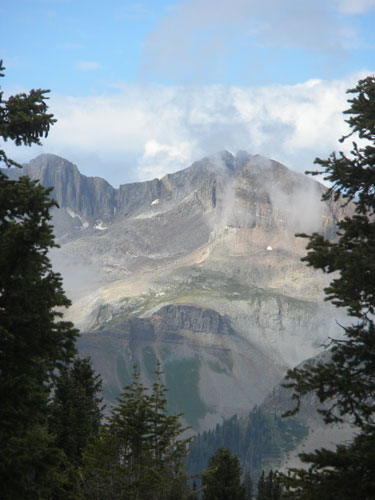
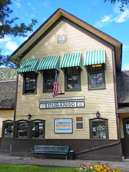
brief moment of sunshine while approaching Durango
Lori
and I have been backpacking together in Colorado's San Juan
Mountains since the early 1980s, but our trips were generally short --
only 2
or 3 days out at a time, then back to civilization for a shower and a
good
meal. We became familiar enough with the trails and mountains
that
occasionally we'd even take groups of friends on treks to our favorite
spots. Hiking the Colorado Trail was something we'd added to our
"Bucket List" while on one of those earlier trips, but we didn't get
serious about it until I "suddenly" had my 60th birthday. Time
(and my "youth") was quickly slipping away. We decided to take
the bull by the horns, damn the business, and "JUST DO IT!" during
the summer of 2010. We spent a lot of the '09 - '10 winter
planning for
the journey, ordering supplies, and updating equipment. All was
ready for
a June departure when Lori discovered she needed an operation.
The medical
staff worked quickly and she underwent a full abdominal hysterectomy on
May
12th. All our plans were put on hold until the doctor gave her
the OK to
go ahead with the trip on June 14th. We began the drive to Denver
(with
many doubts) on June 17th, arriving June 20th. After a few days
of
acclimating to the altitude, our good friend Mike Pyne (Wild West Scale
Model
Builders, www.wildwestmodels.com)
drove us to the trailhead in southwest Denver and our lives began a
major
change.
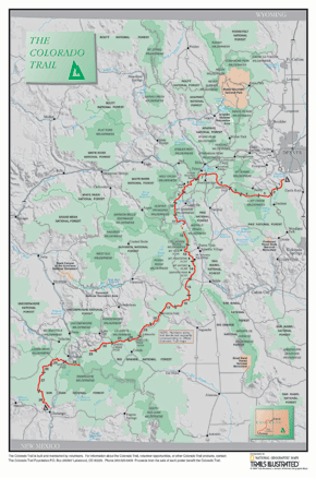
The Colorado Trail (www.coloradotrail.org)
is a continous path running from Denver to Durango, nearly 500 miles in
all. It's divided into 28 segments, the ends of which can usually
be
reached by a car but some sites require a 4-wheel-drive vehicle.
In all,
it enters 6 different wilderness areas, crosses 8 mountain ranges, and
exceeds
13,300-feet above sea level at its highest point. We divided the
trek
into 6 different sections, shipping supplies ahead to towns close to
the
trail. We used the re-supply points to rest, relax, and refresh
ourselves.
The towns were Frisco, Twin Lakes, Salida, Creede, Silverton, and
Durango. Ten of our long-time friends planned to meet us for a
reunion/celebration in Durango, so we were on somewhat of a
schedule. As
it turned out, we managed to cover the distance faster than expected
and spent
more time in the rest stops than first planned in order to make the
final
rendezvous. (We still arrived a couple days early!) We
completed
the hike on August 11th after 41 actual days of hiking, averaging about
12-miles a day.
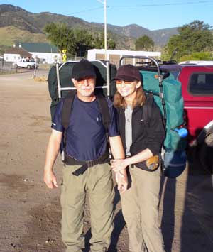
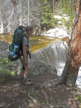
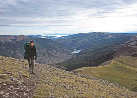
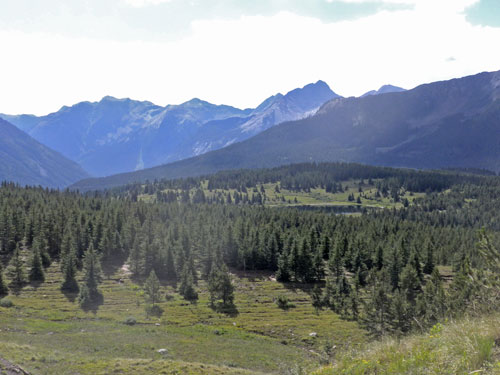
Day 1, apprehensive, overweight
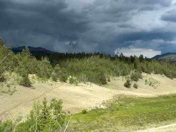
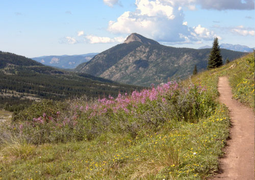
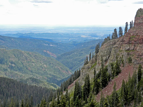
The weather could change quickly!
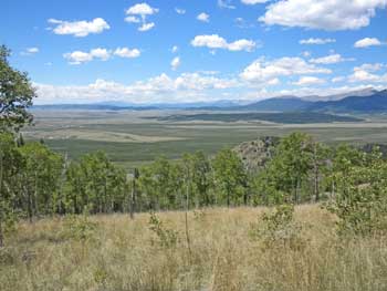
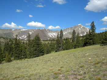
A long
vista of South Park
Of
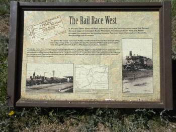
course there was NARROW GAUGE railroading along the way --
it's COLORADO!
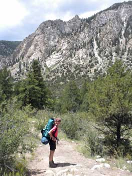
Because
of her recent operation, we weren't sure how Lori was
going to handle the trail, so we started with lighter packs. Mike
and
Korie Pyne met us on the fifth day with fresh supplies for the rest of
the
10-day section. They camped the night with us, and, in spite of
the
snowballs in the morning, wanted to join us for the rest of the
trail. It
was good knowing they were always just a satellite signal away from
rescuing us
if we got into trouble.
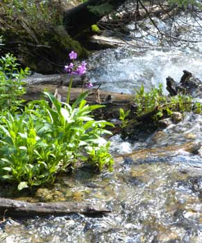
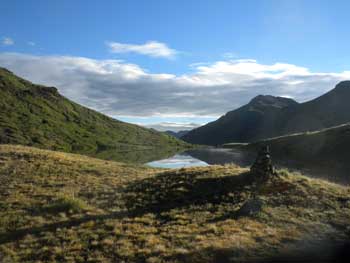
Although
one of the big challenges along the way was finding
water, occasionally we'd encounter an idyllic mountain stream.
Streams
are common in the San Juans, but less so along the CT. One day we
ended
up walking 22 miles to a source, and on another occasion resorted to
catching
rainwater off our tent fly.
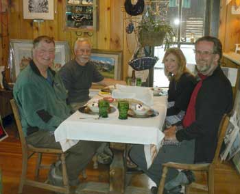
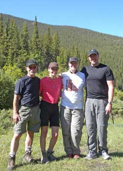
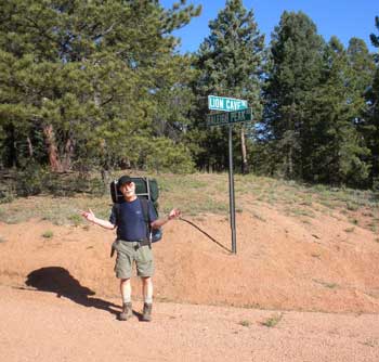
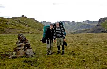
There
were a number of other hikers enjoying all or parts of the
trail. In fact, only a few days were we ever entirely
alone. Here's
a picture of two friends, "Dutch" and "Dioko", that started
the trail the same day we did. We often passed each other along
the trail
and/or hiked together. We also enjoyed some R&R together
(pictured
above in Twin Lakes, CO). When we started Lori and I weren't
familiar
with "trail names", something more commonly found along the
Appalachian Trail in the east. We eventually settled on "Slow"
and "Easy" for our trail names...!
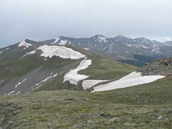
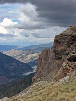
Those
are the "chalk cliffs" above Princeton, CO (left
photo, above). The old Denver, South Park, and Pacific roadbed
could be
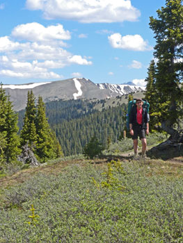
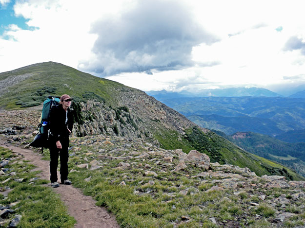
seen far below. The photo to the right shows Lori approaching the
Continental Divide on the first day of the second half of the trek
(after a
lazy layover in Salida). We had full packs, enough for 10 days,
and it
was an 8-mile hike up from nearby Monarch Pass. That made
for a
very long day....one of many!
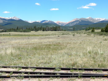
That's
Marshall Pass today. It was easy to imagine
multiple K's pulling long freights over the pass between Gunnison and
Salida. Much of the route is still visible.
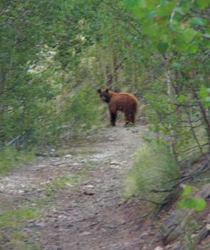
We
spotted a lot of wildlife along the way, but this was the
only bear. We actually felt more threatened by a "mad cow" that
we encountered on a ledge road later on in the trip.
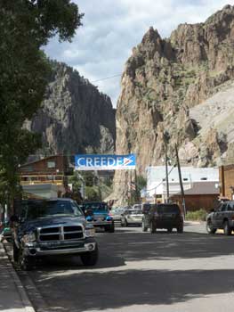
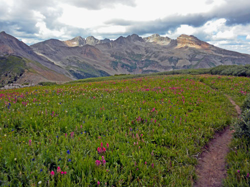
Creede
was one of our favorite resting points, although
difficult to get to. We actually came through that notch in the
background of the photo. Creede has an excellent repertory group
that
performed to a full house while we were there. The photo to the
right was
taken along the trail, far above Lake City, Colorado. That's Lake
San
Cristobal in the distance.
Carrying
a 40-pound pack at 13,000-feet, and going higher.
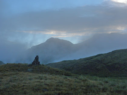
After
leaving Creede, we had to put up with 6 straight days of
rainy weather, all well above the tree line. The only sun we saw
was in
the early morning one day while breaking camp (left, above).
We've been
losing weight along the way and it's starting to show.
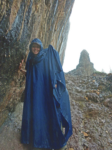
This
was day 6 of the rain. I'm surprised I caught a smile
on Lori's face. The photo was taken near the head of Elk Creek --
the
same Elk Creek the Durango & Silverton stops at a few miles south
of
Silverton (a few miles west of us). It's one of the most
beautiful hikes
in the country...when it's NOT raining!
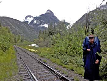

Picking
raspberries along the D&S tracks near Elk Park (left
photo). After emptying out the water from our boots and plastic
bags
around our feet, we started up the trail to Molas Pass -- a 5-mile
climb with
33 switchbacks. It was an 18-mile hike that day to Silverton,
just to
escape the rain. That's the Los Animas River with the D&S
r.o.w.
below. Mount Garfield is the backdrop -- a place I used to hike
into on
weekends to fish (when I was MUCH younger!).
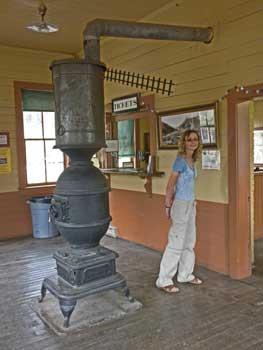
Our
rest stop in Silverton was great, especially if you're a
narrow gauge railroad fan!
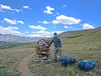
Headed
for Durango on our LAST SECTION! At this point we'd
hiked more than 400 miles and couldn't believe it.
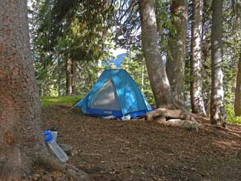
That's
our "home away from home" on the left, and
Lizard Head on the right. Yes, the Rio Grande Southern at last!
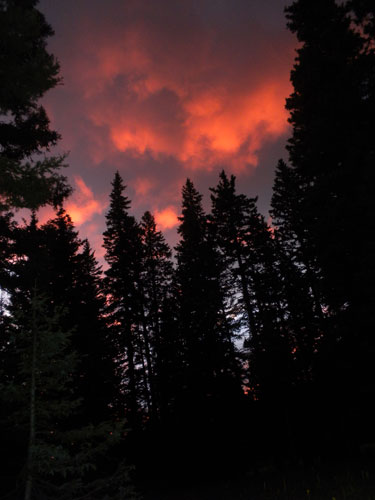
Sunsets
from the tent could be spectacular.
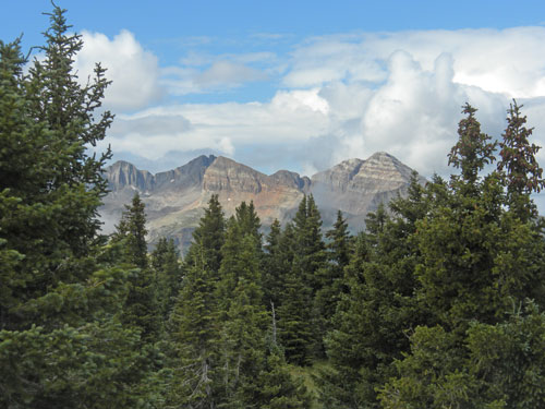
We
encountered a lot of rainy weather along the way, but when it
cleared we really appreciated the country around us.
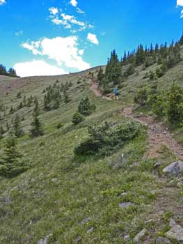
Even though we were into the final section, the going was tough and we
were
still regularly climbing well above 12,000-feet.
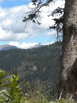
Durango's
FINALLY in sight! (but still two days away!)
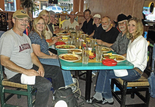
We
made it to the end and our friends showed up to
celebrate. We still couldn't quite comprehend that we'd
backpacked nearly
500-miles and that I'd lost almost 30-pounds in the process. She
lost
weight, too, but won't say how much. The journey definitely
changed the
priorities in our lives, particularly with the business. Life
isn't all
about work work work. I hope you understand!!